Add Third Party base map tiles continued...addWMSTiles()
Web Sevice Map(WSM) based georeferenced map images could used as base map tile using the addWMSTiles()
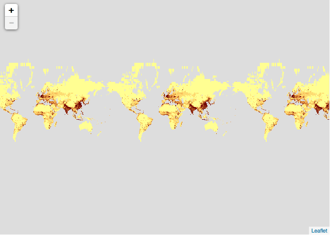
leaflet() %>%
  addWMSTiles("http://sedac.ciesin.columbia.edu/geoserver/wms",
    layers = "gpw-v3:gpw-v3-population-density_2000",
    options = WMSTileOptions(format = "image/png", transparent = TRUE)
  )
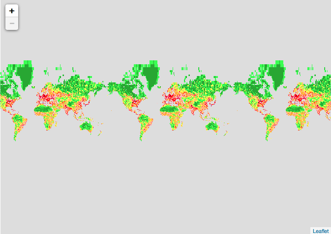
Let us now change the layer to to "human-footprint-geographic"
leaflet() %>%
  addWMSTiles("http://sedac.ciesin.columbia.edu/geoserver/wms",
    layers = "wildareas-v2:wildareas-v2-human-footprint-geographic",
    options = WMSTileOptions(format = "image/png", transparent = TRUE)
  )
# reference :
# http://sedac.ciesin.columbia.edu/data/collection/wildareas-v2/maps/services